Editable North America Map Template for PowerPoint & Google Slides


North America Geographic Map Infographic Template
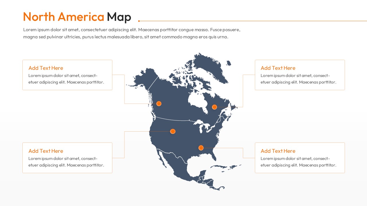
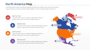
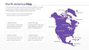
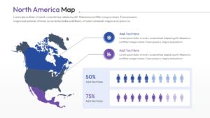
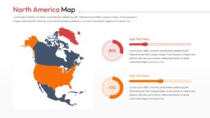
Download this North America Map Template and use case as a central tool for presenting regional data, market presence, or geographical insights with professional clarity. This versatile set of slides allows you to highlight specific countries or territories, making it an essential asset for business expansion plans, educational lectures, or logistics overways. Whether you are pinpointing office locations or tracking sales growth across the continent, these USA Maps provide a grounded visual foundation that helps your audience follow along without effort.
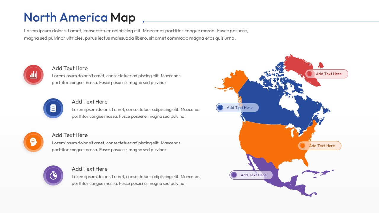
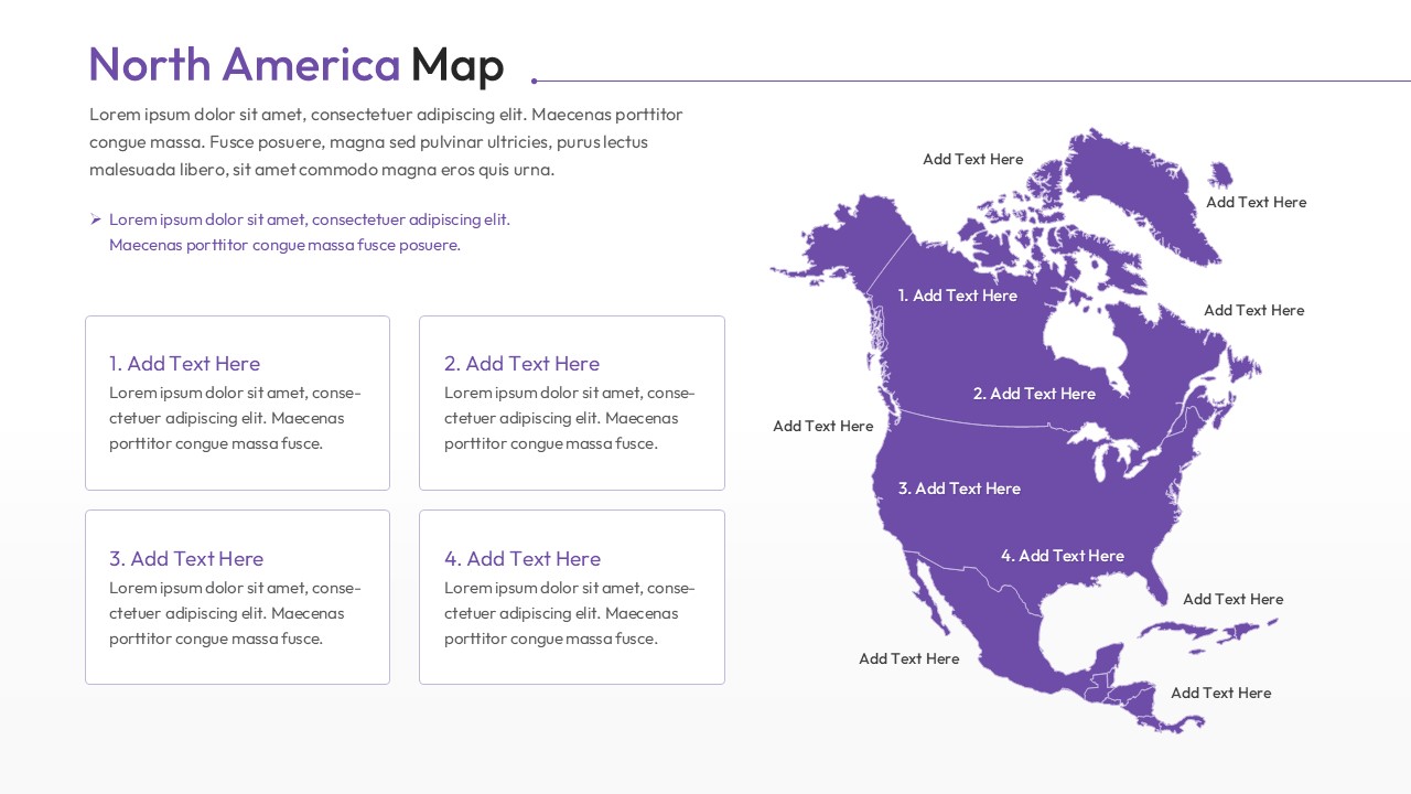
This North America Map Designs features high-quality vector maps of North America, including detailed layouts for the United States, Canada, Mexico, and Central America. The template includes various infographic styles such as data visualization bars, percentage trackers, and pin markers to signify key regions. With its clean and modern aesthetic, you can easily adapt the color palette to match your corporate branding, ensuring your geographic reports look polished and authoritative in any boardroom setting.
These America Maps are ideal for a wide range of use cases beyond simple geography. Use them for supply chain mapping, regional marketing strategy breakdowns, or demographic research presentations. The inclusion of comparative data tools like population icons and growth sliders makes it easy to turn complex regional statistics into a clear story. By using these slides, you can focus on your data while we take care of the design, helping you get from a blank page to a finished deck much faster.
- Save hours of design time with pre-made layouts for continental and country-level analysis.
- Clearly visualize market share across different North American territories.
- Keep your audience engaged with professional, high-resolution geographic infographics.
- Easily customize every element to align with your specific project goals or brand identity.
- Sales managers and business development leads tracking North American market growth.
- Educators and students creating geography or social studies presentations.
- Logistics and supply chain professionals mapping out distribution routes.
- Marketing teams analyzing regional campaign performance or demographic trends.
Why Use these America Map Template
- Communicates geographic data clearly to help stakeholders make informed regional decisions.
- Saves time preparing professional maps with pre-set markers and data visualization tools.
- Reusable for various reports, from quarterly sales reviews to expansion strategy decks.
- Ensures a polished, corporate look that is presentation-ready in minutes.
Who Should Download this North America Map Template
- Business analysts and project managers presenting regional data or site locations.
- Marketing professionals mapping demographic reach and territory-based campaigns.
- Logistics coordinators outlining supply chain routes across North American borders.
- Consultants providing strategic geographic insights for client pitch decks.
Key Features
- 100% Vector-Based Graphics
- Fully Layered & Organized
- Multi-Platform Support
- Theme Color & Theme Font
Frequently Asked Questions
- Can I change the color of individual countries or states?
- Yes, every region is a separate vector shape, allowing you to change colors or move parts independently to highlight specific areas.
- Is this map template compatible with Keynote?
- While designed for PowerPoint and Google Slides, you can easily import the file into Keynote for seamless editing on Mac.
- How do I add text to specific map locations?
- The template includes pre-placed text boxes and call-out lines that you can simply click and edit to add your own data.
Related Templates
-
 $4.99
$4.99 -
-
-